


Last Updated on November 22, 2026 by Michael Motha
Smartphones have become the centre of modern digital life, connecting people through calls, messaging, navigation, payments and countless online services. But the mobile networks supporting these devices could eventually take on a much more unexpected role: helping detect drones flying through the air.
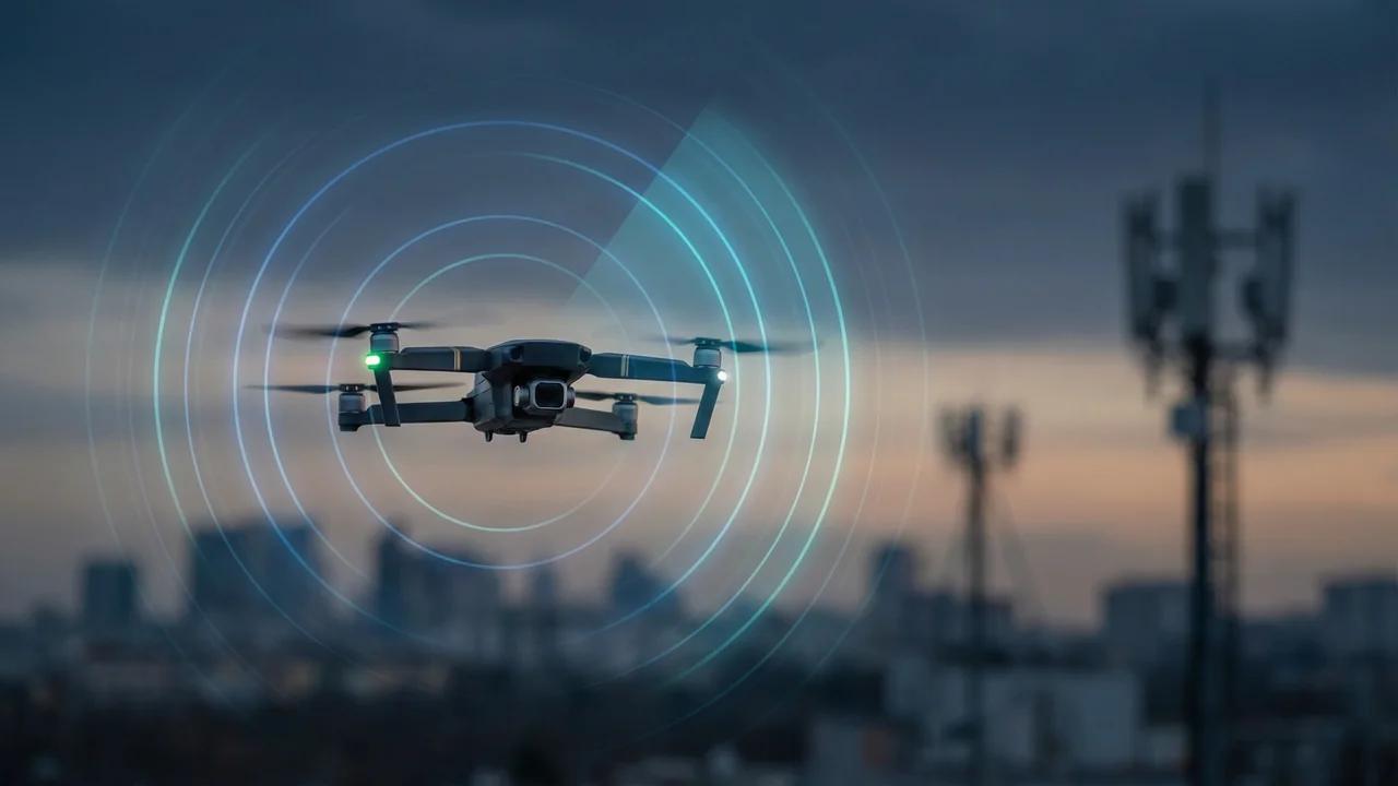
A development announced by Ericsson in November 2026 has brought this possibility into sharper focus. The company introduced an Integrated Sensing and Communication (ISAC) system designed to use mobile-network infrastructure to detect and track moving objects, including small, low-flying drones. Unlike conventional drone-tracking methods that depend on the aircraft transmitting its own location, the approach aims to identify objects by analysing how radio signals are reflected through the surrounding environment.
The development creates an interesting connection between smartphones, 5G infrastructure and the growing number of drones operating around cities, transport networks and industrial sites. It also offers a glimpse of how future mobile networks could evolve beyond communication.
Snapshot: Key Takeaways
- Mobile networks could eventually help detect drones by analysing reflected radio signals.
- Ericsson introduced its ISAC system on 2 November 2026.
- The technology is designed to detect objects even when they are not connected to the mobile network.
- 5G infrastructure, edge computing and advanced signal processing are central to the approach.
- Ericsson expects selected commercial pilots to begin in 2027, with wider deployments anticipated from 2028.
- The system is intended to complement existing detection technologies, not replace every radar or specialist sensor.
Why Mobile Networks Are Looking Beyond Connectivity
For decades, mobile networks have primarily been designed to transfer information between devices. A smartphone connects to a nearby cell site, which communicates with the wider network and helps deliver voice, video and data services.
The next generation of wireless technology is exploring a broader role. Networks may increasingly combine communication with environmental sensing, allowing the same infrastructure to provide information about objects and movement in its surroundings.
This concept is known as Integrated Sensing and Communication. Instead of treating communication and sensing as entirely separate functions, ISAC aims to use aspects of wireless signal transmission and reception for both purposes.
The International Telecommunication Union has included integrated sensing and communication among the proposed usage scenarios for IMT-2030, the framework associated with future 6G development. This does not mean that every 5G network can currently detect drones. It shows that sensing is becoming part of the longer-term direction of mobile-network research.
For the smartphone industry, the implications could be significant. The network that supports a user’s phone may eventually provide additional information about activity in the surrounding area, subject to technical limitations, privacy protections and authorised use.
How 5G Networks Could Detect a Drone
Traditional drone detection systems use different approaches, including radar, radio-frequency monitoring, cameras, acoustic sensors and information transmitted by the aircraft itself. Each method has advantages and limitations.
Network-based sensing introduces another possibility.
A mobile-network site transmits radio signals that travel through the environment. When these signals encounter objects, some energy is reflected or scattered. Specialised receiving equipment and processing systems can analyse those reflections to identify movement and estimate an object’s position.
Ericsson’s ISAC system is designed to coordinate sensing across multiple mobile-network sites. By analysing information collected from different locations, the system aims to improve detection confidence and maintain tracks as objects move through an area.
This is important because a small drone may not always provide a useful identification signal to conventional network-based tracking tools. A sensing system that can detect reflections from an object, rather than relying entirely on the object connecting to a network, could offer an additional layer of awareness.
However, this is not a simple software update that turns every existing mobile tower into a drone detector. Specialised radio capabilities, processing resources, network configuration and suitable site arrangements are required. Performance can also vary according to the drone’s characteristics, its flight path, terrain, buildings, interference and the sensing system’s configuration.
Ericsson’s November Development Puts Drone Detection in Focus
Ericsson announced its Integrated Sensing and Communication system on 2 November 2026 after reporting successful testing over recent months. The company says the system uses sensing-capable 5G radios, edge computing, artificial intelligence and signal processing to detect and track moving objects.
The announcement is notable because the system is intended to detect objects that are not connected to the network. That distinction matters in drone security, where relying only on an aircraft’s own communication signal may leave gaps.
Ericsson has described demonstrations and evaluations involving network operators and partners. These include work with AT&T in Arlington, Texas, and Erillisverkot in Helsinki, as well as a demonstration in Poland involving additional sensing technology.
The company reported that its tests detected and tracked micro-drones at kilometre-scale distances with three-dimensional positioning. These are company-reported test results, not a guarantee that the same performance will be achieved in every city or operating environment.
The commercial timeline is also important. Ericsson expects selected sensing-only commercial pilots to begin in 2027, followed by broader deployments from 2028. The announcement should therefore be understood as an emerging network capability rather than a service consumers can activate on their phones today.
What This Could Mean for Smartphone Users
The most immediate impact of network-based drone detection may not be a new smartphone feature. It could instead come from improvements to the mobile infrastructure surrounding users.
Imagine a future in which authorised security teams receive an alert when an unidentified drone approaches a sensitive location. A network-based sensing system could help estimate its position and movement, while existing security platforms combine that information with camera feeds, radar and other sensors.
A smartphone could then become one of the devices through which authorised personnel receive alerts, view a map or coordinate a response. That is a possible application of connected security systems, not a confirmed consumer feature announced by Ericsson.
There is also a distinction between a smartphone detecting a drone independently and a mobile network detecting one. A phone’s camera, microphone or other sensors may support certain detection applications, but they cannot automatically reproduce the coverage or capabilities of a coordinated network-sensing system.
The evolution of mobile technology is already moving towards more processing at the device and network edge. TechKip previously explored how on-device AI is changing the way smartphones process information. Network sensing could extend this broader shift by giving connected services access to new types of environmental information.
Why Drone Detection Is Becoming More Important
Drones are being used for photography, surveying, agriculture, infrastructure inspection, emergency response and industrial monitoring. Their growing usefulness also creates new challenges for airports, public venues, power facilities, transport hubs and other sensitive locations.
A small aircraft flying at low altitude can be difficult to monitor consistently, particularly in environments containing buildings, trees, traffic and other sources of interference. No single detection method is suitable for every situation.
This is why a combination of technologies is likely to remain important. Radar can provide information about moving objects, radio-frequency systems can identify certain communication activity, cameras can provide visual confirmation, and acoustic sensors can offer another source of evidence.
Mobile-network sensing could add a further layer, especially where suitable cellular infrastructure already exists. It may help security teams identify suspicious movement across wider areas without requiring a separate conventional sensor at every possible observation point.
TechKip has previously examined how beyond-visual-line-of-sight drone operations are moving towards routine use. As these operations develop, reliable airspace awareness will become increasingly important for both legitimate drone operators and organisations responsible for public safety.
The Role of 5G, Edge Computing and Future 6G
Network-based sensing requires more than a strong mobile signal. It depends on radio equipment capable of supporting sensing functions, suitable network architecture and computing resources that can process large amounts of information.
Edge computing could be particularly important. Instead of sending every measurement to a distant data centre, parts of the analysis can take place closer to the radio sites collecting the information. This may help reduce processing delays and support faster responses where the application requires them.
Artificial intelligence may also help distinguish meaningful movement from background reflections and environmental noise. However, an AI classification should not automatically be treated as proof that a particular object is a hostile drone. Detection, classification and identification are different tasks, and each has its own accuracy requirements.
The development also connects with the wider direction of future wireless networks. The ITU’s IMT-2030 framework for next-generation mobile technology includes integrated sensing and communication among its proposed usage scenarios.
This is one reason the technology matters beyond a single company announcement. Mobile-network sensing is part of a wider research and standardisation effort exploring how wireless infrastructure could support additional services.
India’s expanding mobile infrastructure could make the subject relevant to the country’s longer-term technology planning. The Department of Telecommunications publishes updates on the country’s telecom network and 5G infrastructure, although the presence of 5G coverage alone does not mean that a network has the specialised equipment needed for drone sensing.
The Challenges: Accuracy, Privacy and Security
Despite its potential, network-based drone detection faces significant technical and operational challenges.
The first is accuracy. A sensing system must distinguish a drone from birds, vehicles, weather effects and other moving objects. Buildings and complex terrain can affect radio reflections, while interference and changing environmental conditions may influence performance.
The second challenge is coverage. A network may have excellent mobile connectivity in an area but still lack the radio configuration, site density or processing capability required for reliable sensing. Detection performance will depend on the specific deployment rather than simply the number of mobile towers nearby.
Privacy is another important consideration. A system designed to detect objects in the environment must operate with clear rules governing what information is collected, how it is processed, who can access it and how long records are retained. Network sensing should not become an excuse for unrestricted monitoring of individuals or private activity.
Cybersecurity also matters. Sensing data could become valuable to public authorities, infrastructure operators and security teams. Access controls, authentication, secure interfaces and protection against data manipulation will be essential if these systems are used in critical environments.
Finally, detection does not automatically provide a lawful or safe way to stop a drone. Any response must follow the relevant aviation, security and legal requirements. In India, operators and organisations should consult the Directorate General of Civil Aviation’s drone guidance and rules before planning drone operations.
What It Could Mean for India’s Drone Ecosystem
India is developing a wider drone ecosystem covering agriculture, surveying, infrastructure, emergency response and public services. As drone activity expands, the need for dependable airspace awareness is likely to become more important.
Network-based sensing could eventually support selected applications around airports, major public venues, industrial corridors, ports and critical infrastructure. It may also help authorised teams coordinate information from several monitoring technologies through a shared operational platform.
However, India should not assume that a technology demonstrated elsewhere can be deployed immediately across existing mobile networks. Local testing, spectrum considerations, network upgrades, regulatory clarity and coordination between telecom and aviation authorities would be necessary.
For drone manufacturers and service providers, this development also reinforces the importance of designing aircraft and operating systems that can work safely within increasingly connected environments. TechKip’s earlier coverage of AI-powered drones and intelligent flight systems explored how onboard intelligence is changing aircraft capabilities. Network sensing represents a different part of the same wider transformation: making the environment around drones more observable.
Industry Outlook: Mobile Networks May Become Part of Airspace Awareness
The long-term opportunity for ISAC is not limited to drone detection. The same underlying approach could support other forms of movement tracking, positioning and environmental awareness, depending on the technology, deployment and regulatory framework.
For telecom companies, sensing could become an additional service layer built around infrastructure that already supports communication. For public authorities and infrastructure operators, it could offer another source of information for monitoring sensitive areas. For smartphone users, the change may remain largely invisible, appearing through better connected services rather than a new sensor inside the handset.
The timeline will matter. Ericsson’s planned pilots in 2027 and broader deployment expectations from 2028 indicate that commercial adoption is still developing. Real-world performance, costs, interoperability, privacy safeguards and regulatory acceptance will determine how quickly the technology moves beyond demonstrations.
TechKip Perspective
The most interesting part of this development is the changing role of mobile networks. A technology originally built to connect people and devices may gradually become capable of helping organisations understand activity in the physical environment.
That does not mean smartphones will soon become universal drone detectors, or that every 5G tower will automatically identify aircraft. The more realistic possibility is a coordinated system in which specialised network equipment, edge computing, software and existing security sensors work together.
For TechKip, this is an important intersection of smartphones, telecommunications and drone technology. It shows why the future of mobile innovation will not be defined only by faster processors, improved cameras or larger batteries. The networks behind smartphones may become just as significant.
Conclusion
The prospect of mobile networks detecting drones marks an interesting development in the evolution of wireless technology. Ericsson’s November 2026 announcement demonstrates how 5G-based infrastructure could potentially support sensing as well as communication, including the detection of objects that are not connected to the network.
The technology is still developing, and commercial pilots will be important in establishing its real-world value. Accuracy, coverage, privacy, cybersecurity and regulation will all influence adoption.
If these challenges can be addressed, future mobile networks may do more than keep smartphones connected. They could become part of a wider digital infrastructure that helps monitor movement, improve situational awareness and support safer drone operations.
Frequently Asked Questions
Can a 5G network detect drones?
Specialised 5G-based sensing systems are being developed to detect and track moving objects, including drones, by analysing reflected radio signals. This is not a standard feature of every existing 5G network.
What is Integrated Sensing and Communication?
Integrated Sensing and Communication, or ISAC, is an approach that combines wireless communication with sensing capabilities. It aims to use network signals and infrastructure to gather information about objects and movement in the surrounding environment.
Did Ericsson launch a drone detection system in November 2026?
Ericsson announced its ISAC system on 2 November 2026. The company says it is designed to detect and track objects such as drones using sensing-capable mobile-network infrastructure. Selected commercial pilots are expected in 2027.
Can my smartphone detect a drone using 5G?
Not through the Ericsson system as an ordinary built-in smartphone feature. The proposed detection takes place through specialised mobile-network equipment and processing systems. A smartphone could potentially display alerts or information from an authorised service.
Will 5G drone detection replace radar?
There is no basis to assume that it will. Network-based sensing is better understood as a potential additional source of information that could complement radar, cameras, radio-frequency monitoring and other detection systems.
Will this technology be available across India soon?
There is no confirmed nationwide rollout timeline for India. Deployment would require suitable network equipment, testing, regulatory coordination and commercial decisions by telecom operators and other stakeholders.